Blog about a trip to Great Falls
We went over to Great Falls on Wednesday (March 13th) and came back yesterday. A quick trip, but we had some business to attend to over there and the weather was great, so we ‘got our act together’ and went. Of course ‘getting our act together’ so to speak, is a monumental task in itself…… Anyway, please follow along with us. The weather was beautiful, a little cold, but sitting there in your cozy chair, snuggled up in your favorite blankie, you won’t notice the cold at all……
Starting out across US-2 (if we go anywhere we have to get on US-2) our first stop was the break in the mountains where the Flathead River comes out of the Rocky Mountains into the Flathead Valley. This narrow canyon is only a few hundred feet wide with Teakettle Mountain on the North side of the Flathead River and the Columbia Mountain on the South side. We often stop here in the early mornings just to enjoy the view, and Wednesday was no exception.
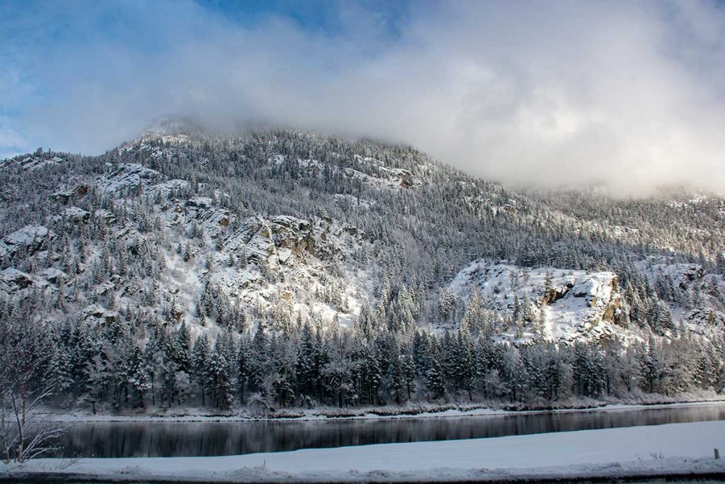
Teakettle Mountain above the Flathead River
There is still some open water in the Flathead as it does not usually freeze over. It is only a few miles downstream from the Hungry Horse Reservoir and there is a lot of water coming out of the dam that keeps the water moving quite rapidly in the Flathead.
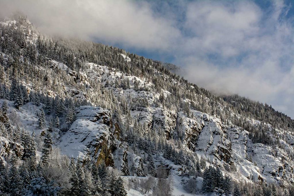
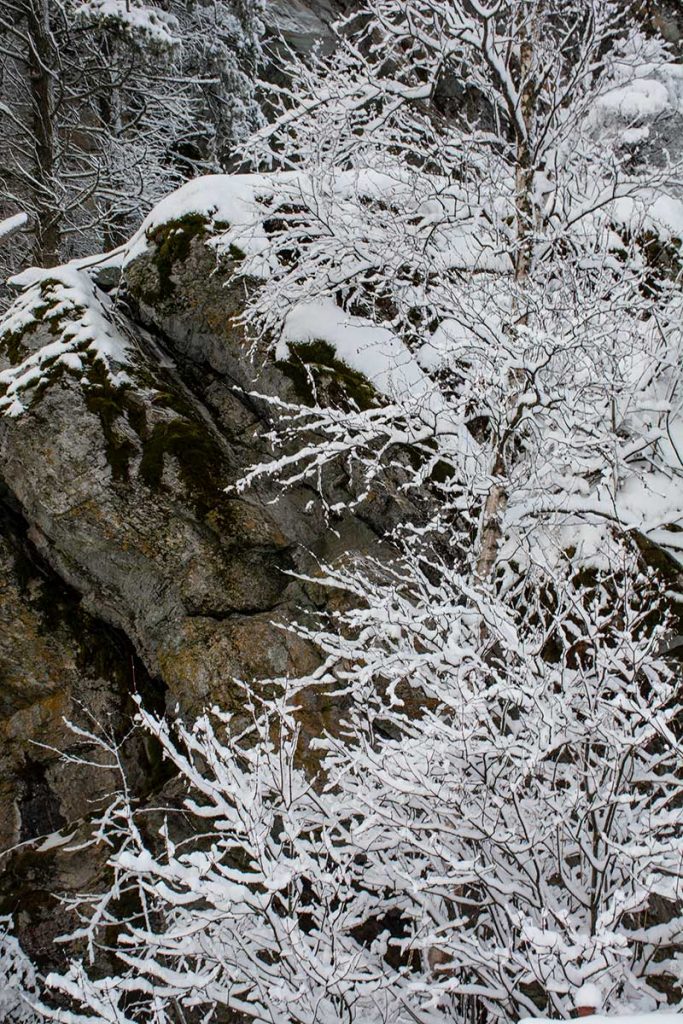
Looking up at Teakettle Mountain
The landscape of Teakettle Mountain is very rough. Many outcrops of rock make the Mountain look more like a huge pile of rocks than a ‘normal’ Mountain, if there is such a thing as a ‘normal.” It is sparsely covered with evergreen trees and the snow accents the rock formations.
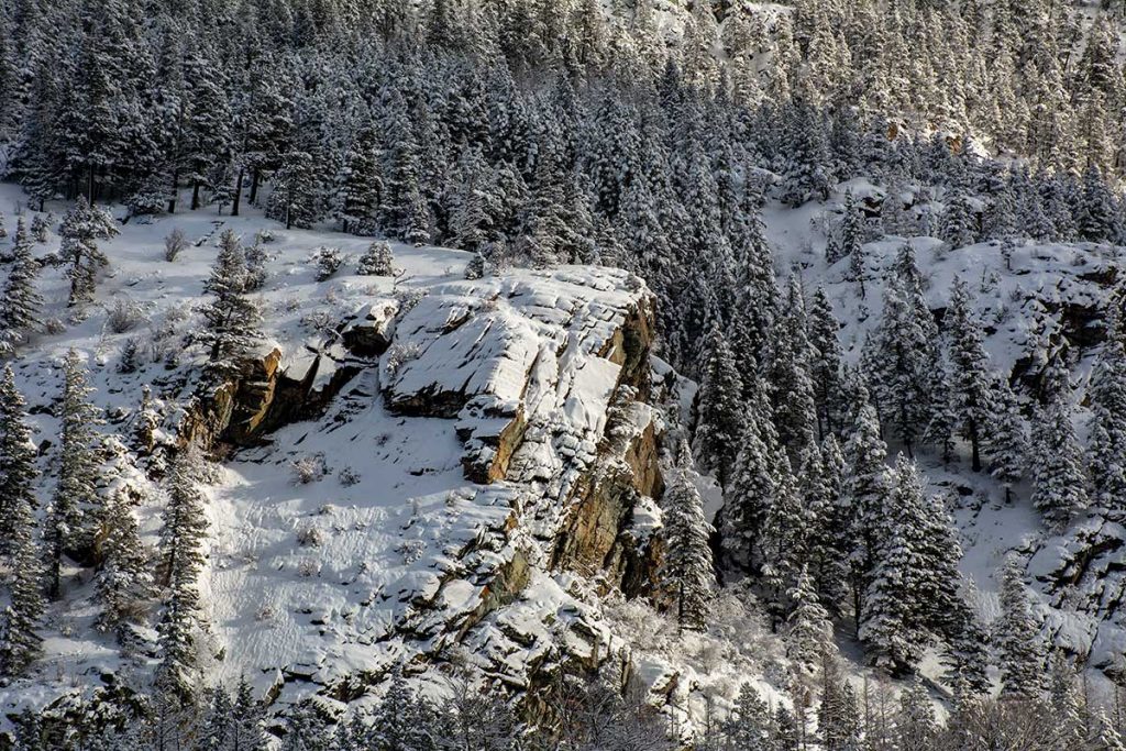
Morning Sun on the Rocks
The Morning Sun was striking the rocks and touching the treetops. The snow last night came down so gently and just covered the trees with a layer of powder.
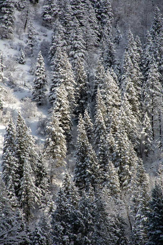
How these trees grow on an almost vertical surface, that is mostly rock, is hard to imagine. They don’t look very large, but they are very old for their size. The only nutrients they get is in the dust that has settled in the rock crevices. There is almost no soil on the Mountain, just little pockets of crushed rock and dust blown in from the Flathead Valley. Hard way to make a living….
To our back, Columbia Mountain
As we were looking across the Flathead River and taking a few photos of Teakettle Mountain, Debbie turned around and captured this moment. Powder Snow on the limbs of an aspen against the rocks of Columbia Mountain. I told you that this canyon was narrow. The highway, (US-2), is cut into the cliffs of Columbia Mountain to make a road through the canyon between the River and Columbia Mountain. The Railroad is cut into the cliffs of Teakettle Mountain on the North side of the River.
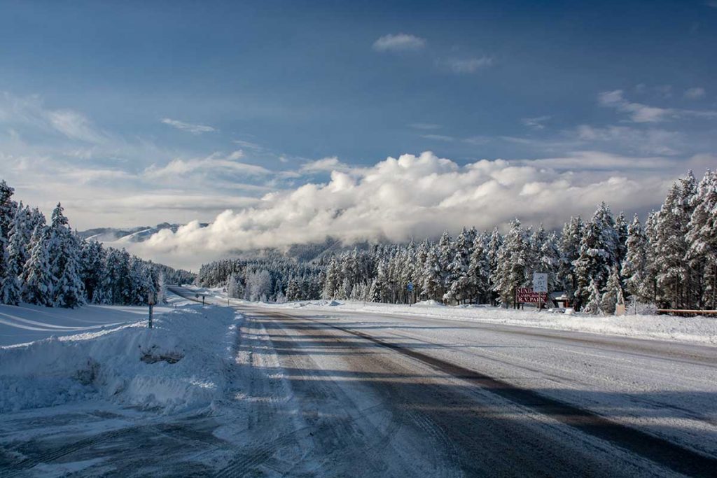
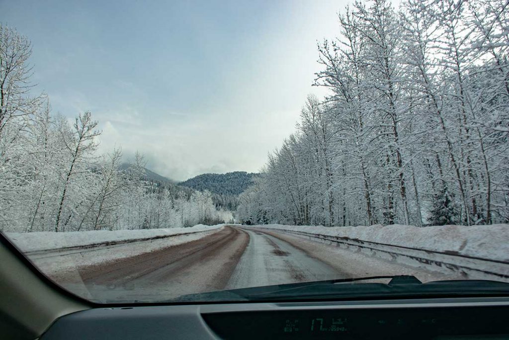
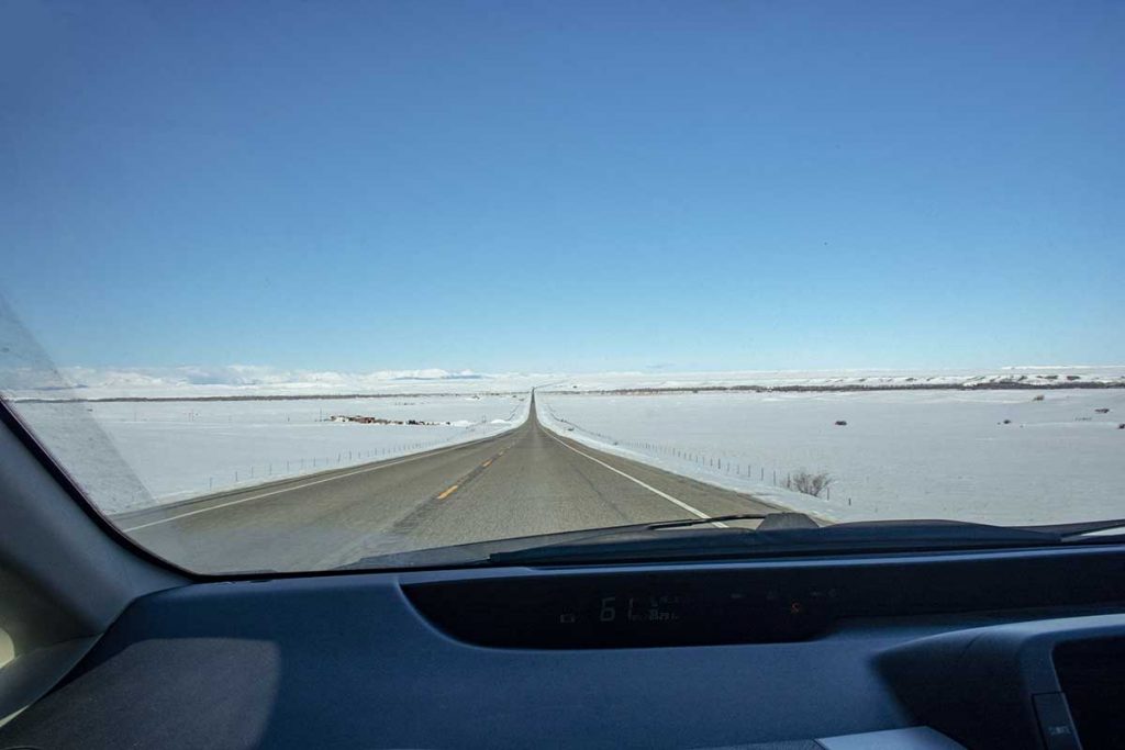
US-2
As we continued on our journey, we stopped and looked back west on US-2 to give you a feel of how the road conditions were. Snow covered, but the crews were plowing off the roads. Driving carefully, the roads are not bad. We do have studded tires on for the winter and they give us some confidence. As you can see, the weather was perfect. What a beautiful day for a drive… so stay with us!
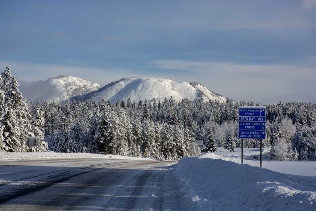
Looking East at Apgar Mountain
Just turning around and looking East, we see Apgar Mountain. Debbie and I hiked to the top of it last Summer and photographed the Forest Fires burning on Howe Ridge just to the North of Apgar. It’s like living in a Christmas Card out here! Just a note, as we returned on Thursday, the snow had completely melted off the highway and the roads were clear and dry.
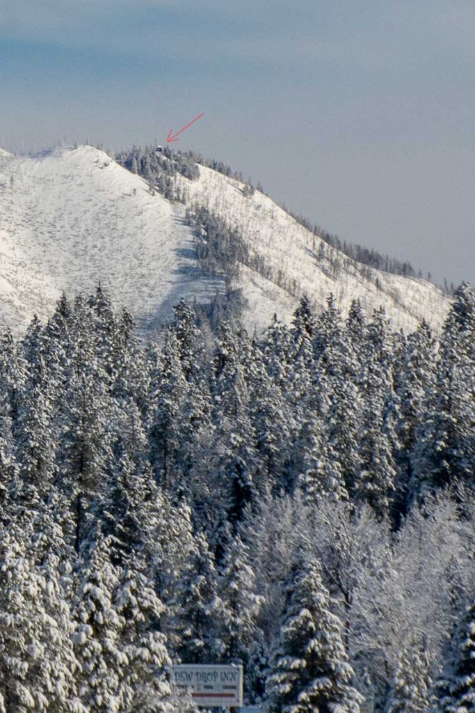
Apgar Lookout
Just thought I would show a close up of the previous photo of Apgar Lookout at the top of the mountain. That was the destination of the hike last Summer. That trail is 7.1 miles and considered ‘Strenuous’ by all of the trail publications that we have seen. It gains 1,845 feet to an altitude of 5,228 feet at the Lookout. To say the least, we were exhausted when we arrived back at the parking lot after the hike!
Going along the Middle Fork of the Flathead River
As we continued up the Middle Fork of the Flathead River the scenery was totally awesome! The deciduous trees were covered with the powdery snow, making our drive spectacular. Are you still with us??? The drive on US-2 from Columbia Falls the Maria’s Pass is one of our favorite drives, any time of the year. (Yes….sometimes we do shoot through the windshield! We want you to see things just as we do. Not too many pull-offs are available in winter!)
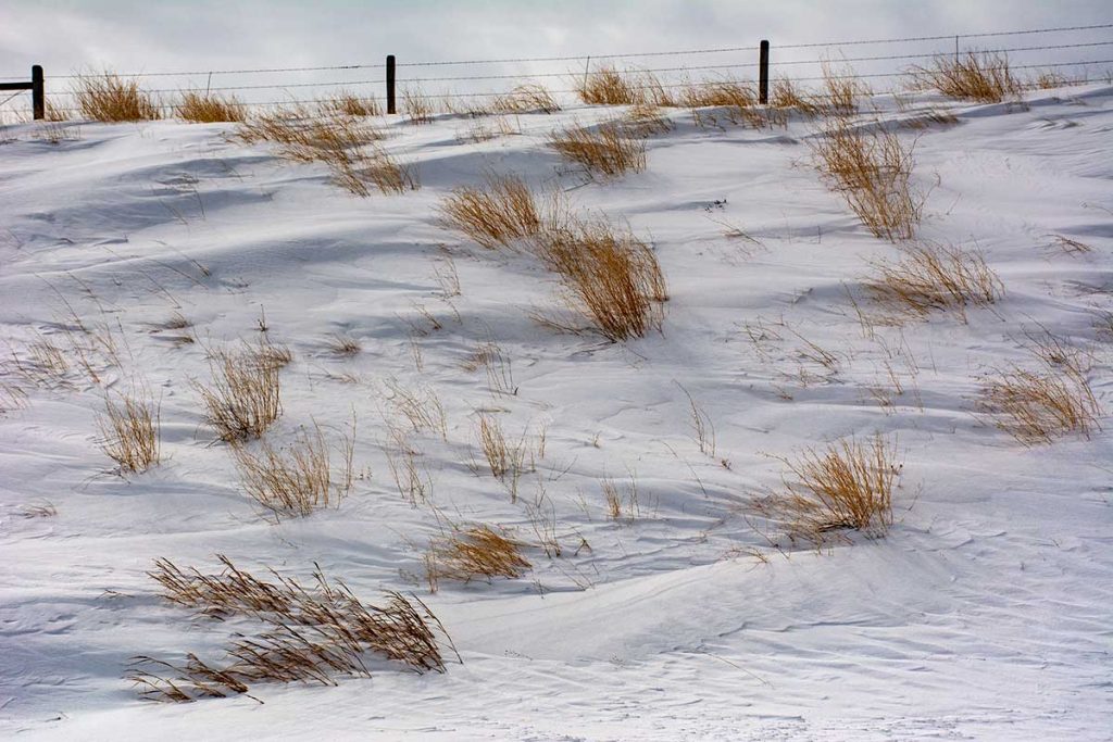
Snowy Landscape
The weather was Cloudy on the East side of the Mountains and when we got to Maria’s Pass we could hardly see Summit Mountain so we continued on to Great Falls. Debbie captured some interesting landscapes along the way, like this one of patterns in the snow with the contrast of the grasses.
Giant Springs State Park
After taking care of our business in Great Falls, we had some time to go by the Giant Springs State Park and Fish Hatchery. If you find yourself in Great Falls, the Giant Springs is a wonderful place to visit. Over 150 Million gallons of water flow from the Giant Springs every day and cascade into the Missouri River. William Clark commented on this Spring on the Lewis and Clark Expedition in 1805. There has been some controversial theories about the time it takes the water to reach this Spring from the Little Belt Mountains, but now it is thought that it takes less than 50 years to get here. Still that is a long time to wait for a drink of water!
Water boils up out of the rocks with great force
The water boils up out of this spring with great turbulence. There are many places this is evident.
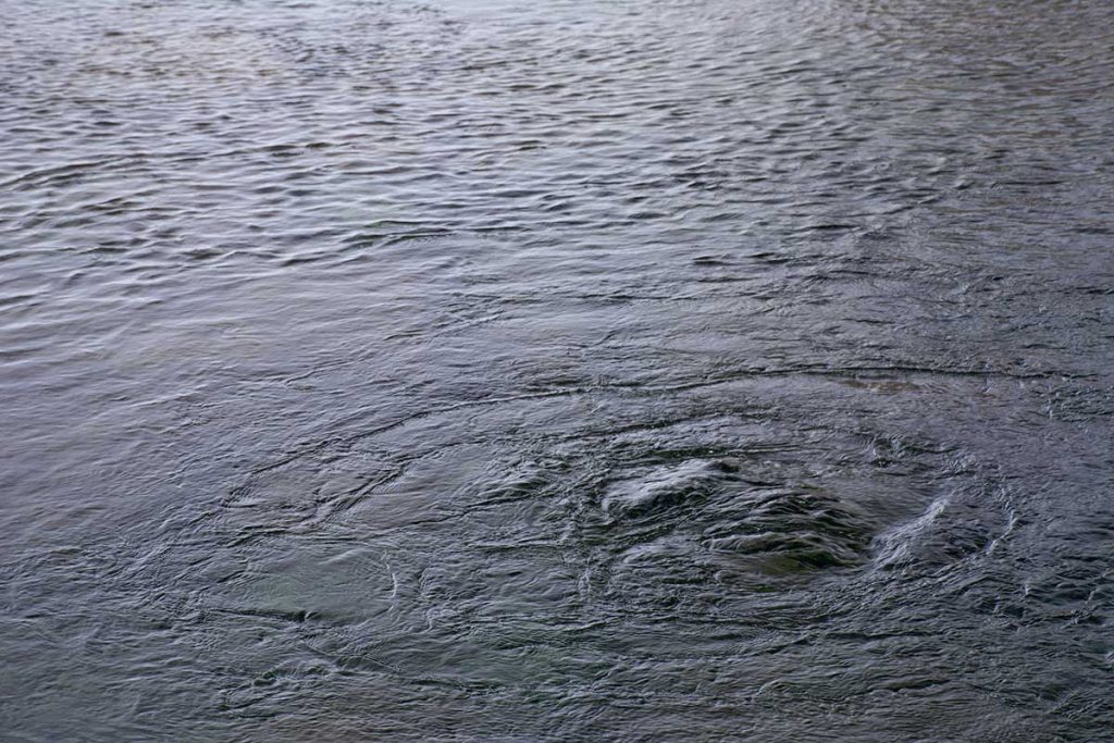
Rolling Turbulence
This is just a few feet from the edge of the sidewalk around the Springs.
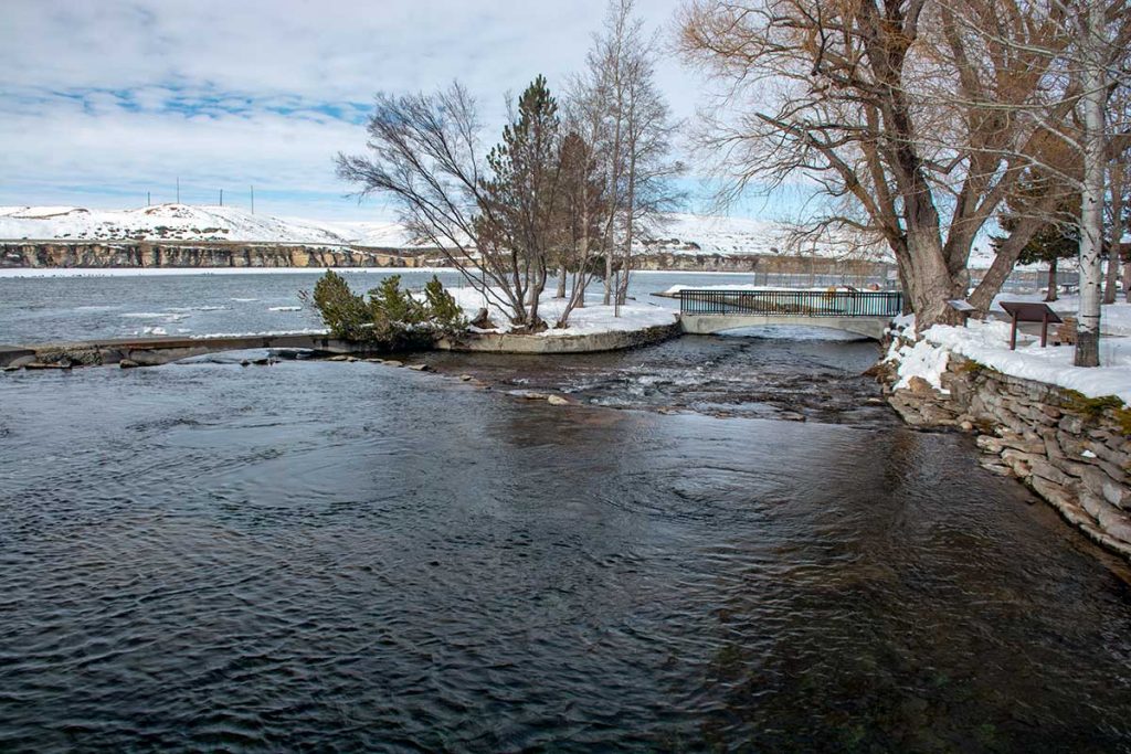
Roe River
The Roe River is recognized as the World’s Shortest River by the Guinness Book of World Records. The Roe River runs from the Giant Spring, of which we are standing on the opposite side, to the Missouri River, a total length of 200 feet! It has it’s very own bridge! The bridge was built by the WPA workers in the 1930’s. But at a whopping 200 feet, I guess they thought it must have it’s own bridge.
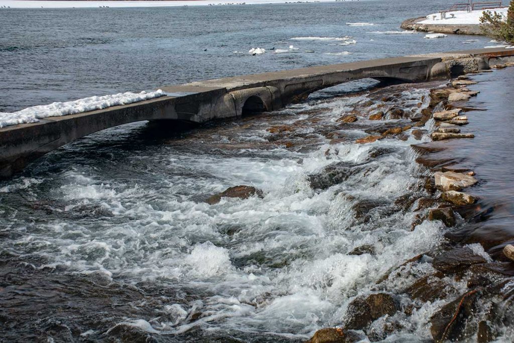
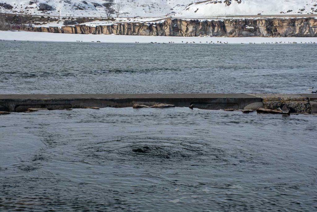
Sidewalk built by the WPA
It is interesting to walk around the sidewalk out into the Missouri River watching the waterfalls of crystal clear water come cascading out of the Spring. If you take note of the snow on that walkway, we chose to stay put and not risk the chance of falling off into the near freezing waters. It was a very windy, cold day to even be out there!
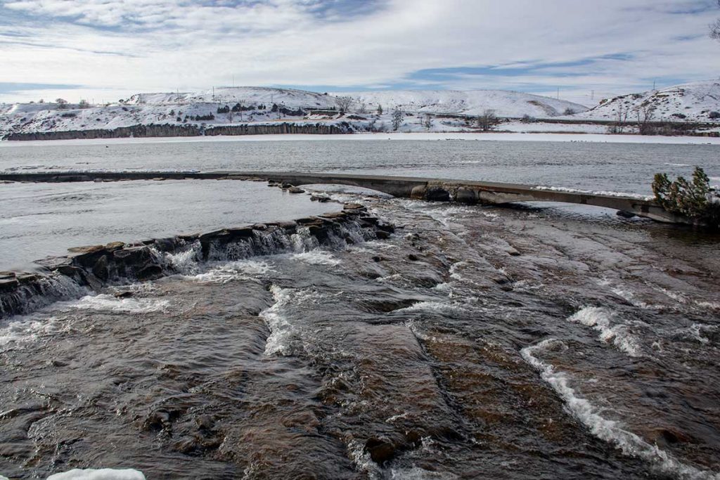
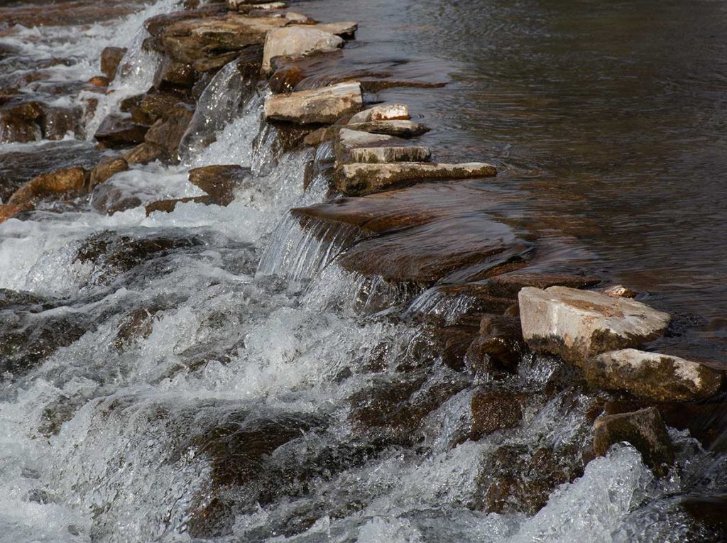
Like a Stairway for Water
The Spring waters flow down over the fractured rocks that resemble a stairway to the “short” Roe River.
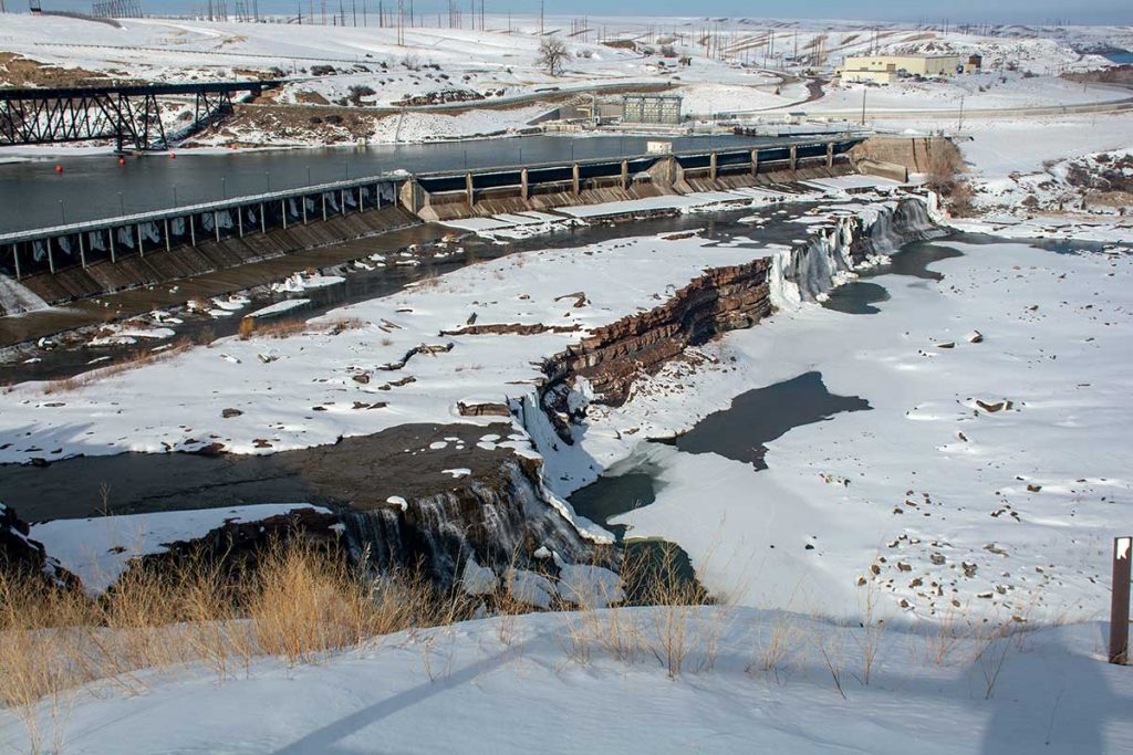
Rainbow Falls
While visiting the Giant Springs State Park, we continued on past the Park to Rainbow Falls. We had not been to Rainbow Falls and thought we might have a look. It is an awesome waterfalls. Lewis and Clark named 4 of the 5 waterfalls here and two of them still have those names, Great Falls and Crooked Falls. Upper Pitch was changed to Black Eagle Falls and Beautiful Cascade was changed to Rainbow Falls. Colter Falls was named later. We hope someday when we are visiting the area again, to be able to walk down to this falls and get a real grasp of its size. Falls are always minimized when you look down on them.
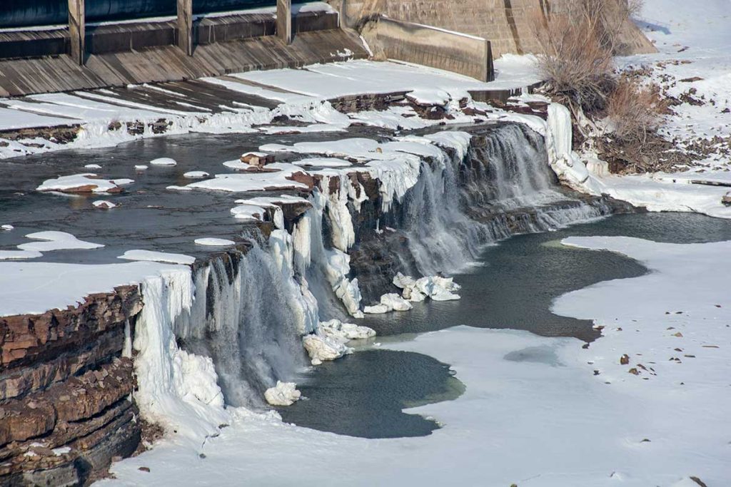
North side of Rainbow Falls
It is hard to imagine the difficulty of portaging these falls as Lewis & Clark were forced to do. They did an 18 mile portage around these five falls in twelve days. This was considered one of the most difficult parts of the journey by the expedition.
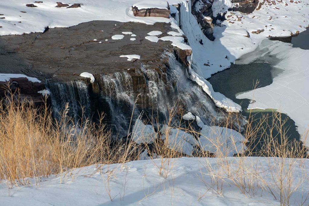
South side of Rainbow Falls
We opted to stay close to the car as the temperature was still in the 20’s, but plan to come back to this location in the Spring and visit all of the four dams still visible. Colter Falls has been submerged by the dam here at Rainbow Falls.
Morning Sunlight on the ‘Bob’
After a good nights sleep, we headed North on 89 along the Bob Marshall Wilderness area. The Bob Marshall Wilderness, the Great Bear Wilderness and the Scapegoat Wilderness extend for over 100 miles South of Glacier National Park. We had clear roads all the way back to Columbia Falls which had been snow covered yesterday.
As we continued north the ‘Bob’ was visible all the way to Browning
Heading on up 89, we could not help ourselves from stopping often to shoot more photos as the lighting was awesome.
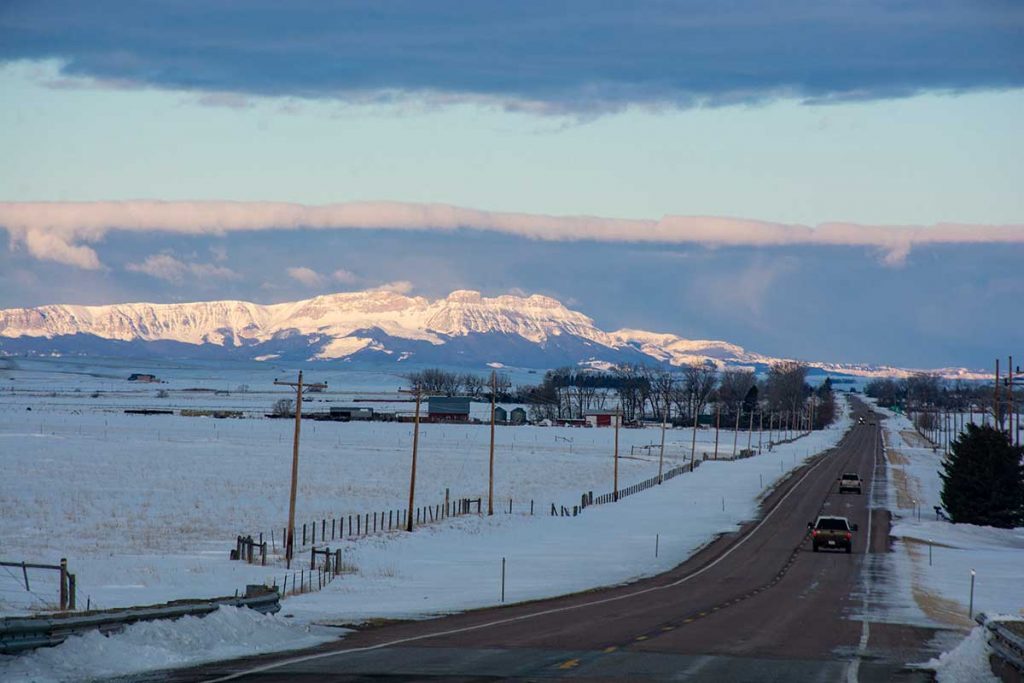
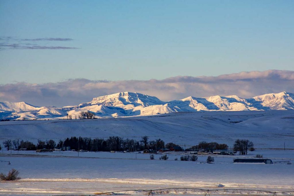
Beautiful Farms in the edge of the Great Plains.
We noticed a road that we had not taken before and thought we would drive back into the ‘Bob’ as it is only 20 miles to those mountains you see.
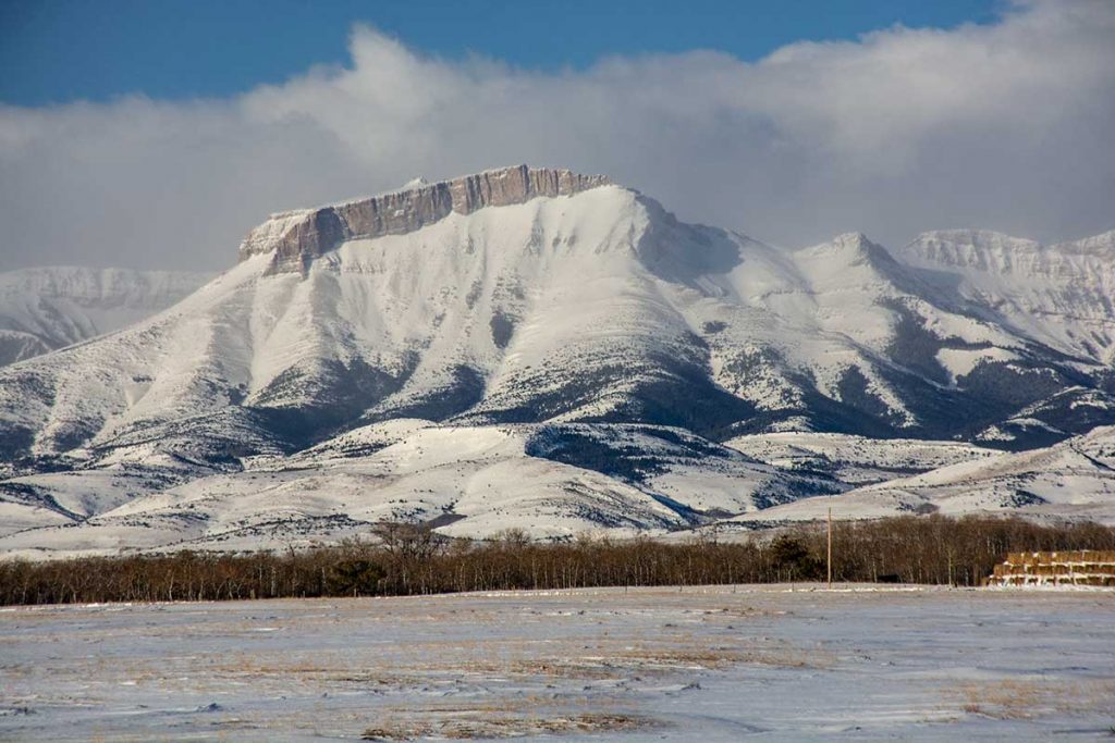
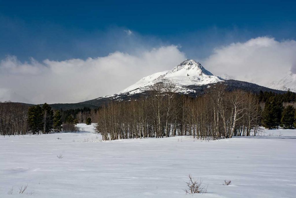
Ear Mountain
As we got into the ‘Bob’ we stopped to shoot Ear Mountain. What a beautiful day! (but the wind was horrendous)
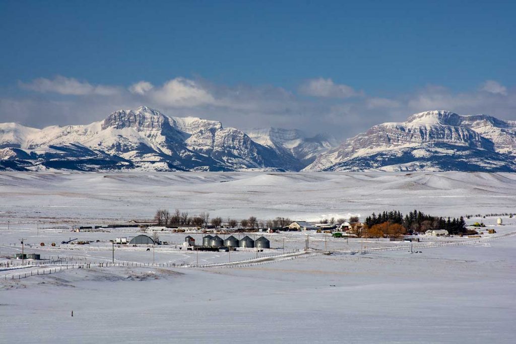
Mountain views everywhere
The Bob Marshall Wilderness, as the locals around here call the ‘Bob’, is huge at 1,577 square miles. It is the Rocky Mountains south of Glacier National Park and is ever bit as beautiful as Glacier, but just doesn’t have as many roads. Tourists are few and we hope to spend a lot of time exploring this area.
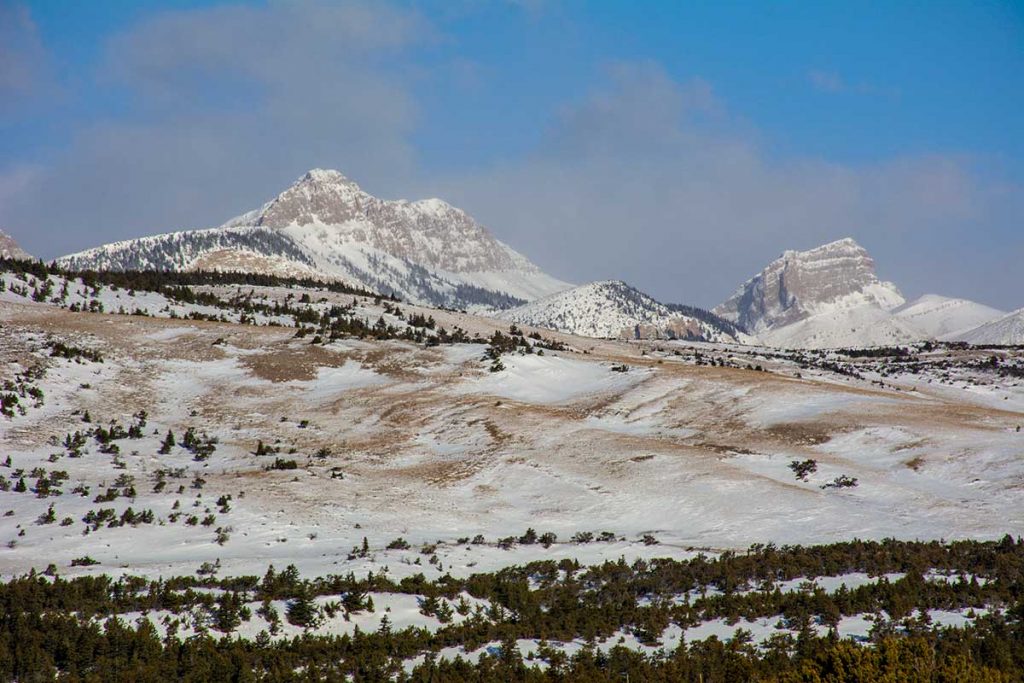
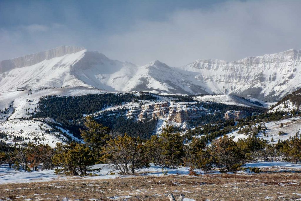
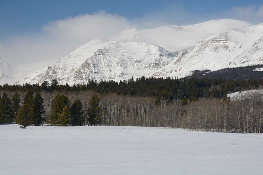
Choteau Mountain
Turning northward, we see Choteau Mountain. So great is the landscapes in this Nation! Everywhere you turn, totally awesome…
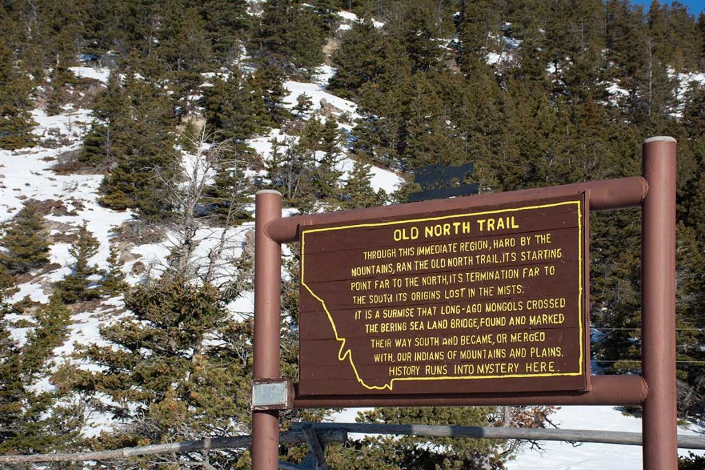
A bit of History here at the ‘Bob’
This sign is right where the Great Plains meet the Mountains in the “Bob”. Just something to ponder, in case you need something else to think about.
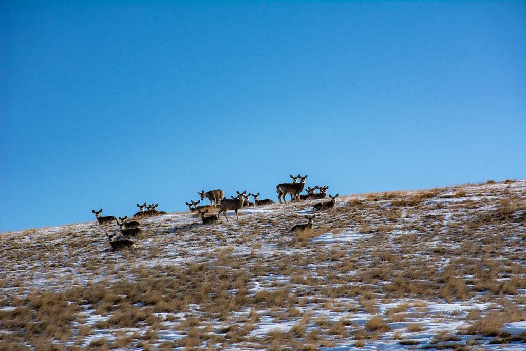
Mule Deer watching us intently
As we were driving along 89, we noticed a herd of Mule Deer bedded down for a mid-day siesta. Notice the size of those ears!
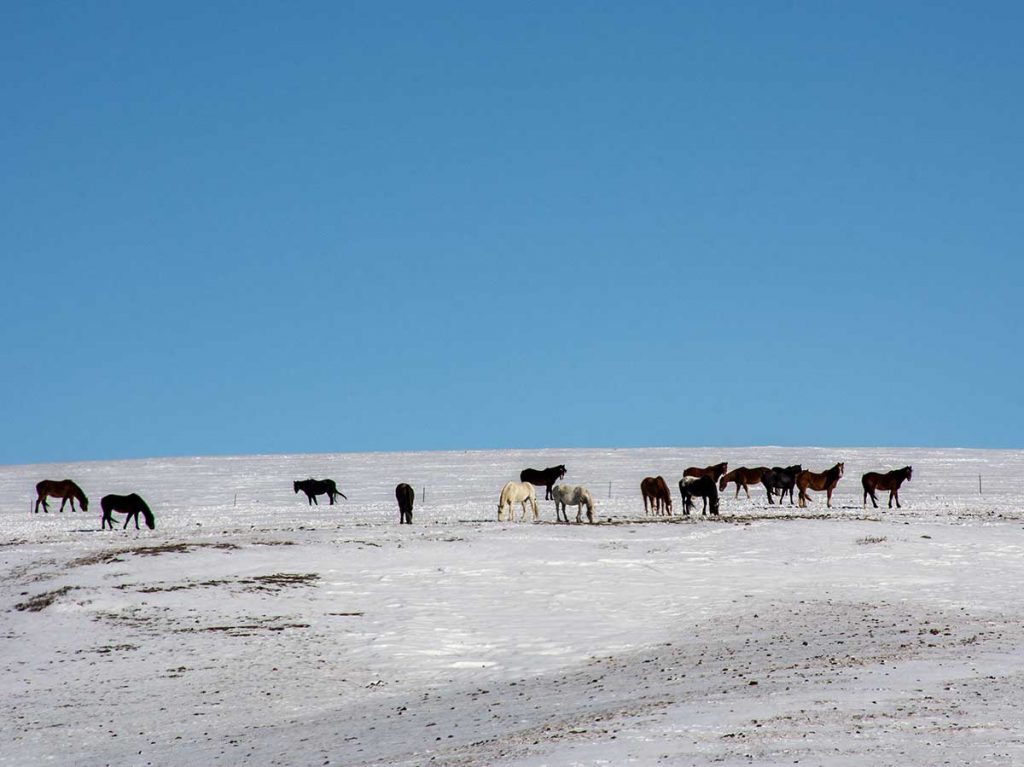
Lots of Horses along this route
The Native Americans, Blackfeet in this area, have lots of horses. They use them for roaming around with their cattle and buffalo. This is the western side of the Great Plains and the cattle and buffalo roam over thousands of acres. It would take a lot of gas to replace a horse out here. Although they do use 4-wheelers for some of the roundup, the horse is still a great, (best) choice.
Where the Great Plains meet the Sky
Nearing Browning, yet 20 miles away, we could see Rising Wolf Mountain and following the line of Mountains to the right, Chief Mountain was visible, 57 miles from us. Out here on the Great Plains it is easy, on a clear day, to spot landmarks more than 50 miles away.
Dancing Lady Mountain
We continued on to the intersection of 89 and US-2. After refueling in East Glacier, we drove through East Glacier Park and turned onto 49 just out of town to shoot a photo of Dancing Lady Mountain to compare the snow cover with photos from last year. Yes, there is less snow this year by far.
Mountains North of Dancing Lady Mountain (forgot the names, have to look them up)
Just checking the snow to the North of Dancing Lady Mountain. There is a noticeable difference in the snow depth as to the approximate time frame as last year.
We continued on home without incident; of course at our age ‘without incident’ is good! The roads were all clear and travel was good, We just enjoyed looking at the awesome scenery.
We hope you have enjoyed the trip with us. We know the photos are nothing like being there, but you have to come out here to ‘be there’.
If you enjoyed the trip, leave us a note to let us know. That is the only way we have of knowing if anyone read this Blog.